
|
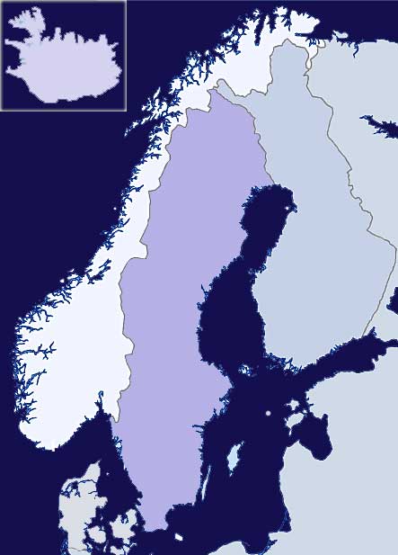
HISTORICAL MAPS of Scandinavia: Bronze Age - Early Germanic Migrations - Early Scandinavian Trading - VIKINGS - Post-Vikings - DNA Mapping 01. Wikimedia Map showing early migrations in Europe and Southern Scandinavia from 150 to 500 A.D. (Note that by using the forward arrow on the webpage, you can view other historical maps.) 02. Periodis Web - Historical Atlas and Gazetteer of Europe. Shows European and Southern Scandinavian country borders in 100 year increments from Year 1 to 2000. 03. Map of Scandinavia, including Norway, Sweden, Denmark, Finland, and the Baltics dated about 1715 by Johann Baptist Homann, 1664–1724, a German geographer and cartographer.
04. Historical Maps of Norway at Kartverk from Norwegian Mapping Authority - Free downloadable printable Historical Maps of Norway, including County Maps. Note: These maps can be helpful in understanding the geographic area in which your ancestors lived - helpful for finding marriage partners, parents, siblings, etc. Do NOT use English language link on top of page for English language as it currently eliminates most choices.
Above Free Maps of Norway as translated by Google - Google's English translation of the above page. HOWEVER, you will need to use the original Norwegian version above to use links to navigate the website or do searches. (Try using 2 or more browser windows, 1 for each translated page plus one with the original page, to help with exploring and navigating this website.)
05. Old Maps Online Interesting collection of historical maps, including many for Scandinavian countries
searchable by country, date range, and even many counties or large towns. |
|
||||||||||||||||||||
|
The History of Scandinavia: Bronze Age - Early Germanic Migrations - Early Scandinavian Trading - VIKINGS - Post-Vikings - DNA Mapping Please Note - This page, the Scandinavian Origins and DNA page, and the Vikings page are all under construction/reorganization. - WebmasterWas there a Viking Age in Norway — 2000 years before the Vikings? It may be that people from the North went to the Mediterranean with "Viking ships" as early as 3000 years ago. This article discusses Pre-Viking ships and how far they probably traveled in them. Scandinavian History - Summaries (see also Individual Countries, below)
01.
The History of Scandinavia at Wikipedia - the history of the geographical region of Scandinavia and its peoples.
01.
Germanic Tribes - Rugii (Rugians) (Suevi) - Scandinavia c AD 100. "The Germanic tribes seem to have originated in a homeland in southern Scandinavia (Sweden and Norway, with the Jutland area of northern Denmark, along with a very narrow strip of Baltic coastline). They had been settled here for over two thousand years following the Indo-European migrations. The Germanic ethnic group began as a division of the western edge of late proto-Indo-European dialects around 3300 BC, splitting away from a general westwards migration to head towards the southern coastline of the Baltic Sea...." 01. Map of Scandinavia c.AD 100 Note: Click on tribal location on the map to go to their page about that tribe. 02. Map of Scandinavia AD 814- showing Kvendland 03. European Kingdoms - Fenno-Scandinavia/Nordic Countries - Kvenland "a vast, ill-defined reach of Scandinavian and Fennoscandian territory which at the end of the Viking Age still encompassed not only most of modern Finland, but also the northern two-thirds of modern Sweden and Norway and part of north-western Russia."
08.
Migration of Nations: Migration of mainly Germanic groups in Central and Southern Europe between 375 and 568
Wikipedia article on the various early migrations in Europe and Scandinavia (translated via Google Translate),
including Maps of early Europe and Southern Scandinavia. The History of Norway: Bronze Age - Early Migrations - Early Swedish Trading - VIKINGS - Post-Vikings - DNA Mapping 01. European Kingdoms - Norway (Norge) Excellently written History of Norway at The History Files. Includes historical timeline and text covering origins of the Original Inhabitants (including Sámi tribes) and Tribal Immigrations into Norway up through current royalty. The History of Sweden: Bronze Age - Early Migrations - Early Swedish Trading - VIKINGS - Post-Vikings - DNA Mapping 01. European Kingdoms - Sweden (Swedes / Suiones) Excellently written History of Sweden at The History Files. Includes historical timeline and text covering origins of the Original Inhabitants (including Sámi tribes) and Tribal Immigrations into Sweden up through current royalty. The History of Denmark: Bronze Age - Early Germanic Migrations - Early Scandinavian Trading - VIKINGS - Post-Vikings - DNA Mapping 01. European Kingdoms - Denmark (Danes) Excellently written History of Denmark at The History Files. Includes historical timeline and text covering origins of the Original Inhabitants (including Sámi tribes) and Tribal Immigrations into Denmark up through current royalty. The History of Finland (Suomi): Bronze Age - Early Germanic Migrations - Early Scandinavian Trading - VIKINGS - Post-Vikings - DNA Mapping (see also Kvenland in Scandinavian History section above) Map of Scandinavia AD 814- showing Kvendland 01. European Kingdoms - Fenno-Scandinavia-Nordic Countries - Finland. Article at The History Files 02. Northern Europe - Finland as a Grand Duchy of Russia (1809-1917). Article at The History Files The History of Iceland: VIKINGS - Post-Vikings - DNA Mapping "The reason Alexander Ludwig regrets playing Bjorn on Vikings" 01. Tidbits about the Historical basis, actors, and intentions of The Vikings TV Series |
||||||||||||||||||||
|
